![]()
![]() exploring Bremen & its surrounding areas
exploring Bremen & its surrounding areas
![]() your are here: worth seeing in Walle district
your are here: worth seeing in Walle district
 Metalhenge: On Bremen's highest hill with astronomical views
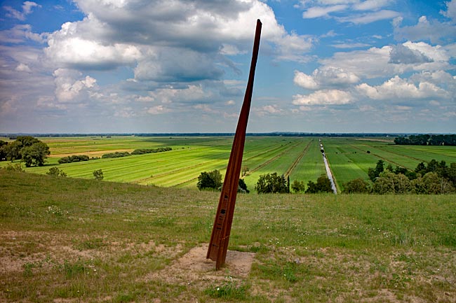
Since 1969, it has been growing - first in height and more recently in length. The subject is the highest elevation in the Hanseatic city of Bremen, artificially created and affectionately referred to by its residents as "the mountain": the garbage dump. After just over 50 years, in July 2021, the first construction phase of the 40-hectare landfill in Blockland was opened to the public for exploration. Anyone imagining images from distant lands of people sifting through stinking waste for still-usable remnants is mistaken - there’s no hint of garbage here. On the contrary, after its decommissioning and surface renaturation, this compacted accumulation of human-cultural remnants alongside the A27 highway to Bremerhaven presents itself to visitors as a green, treeless landscape.
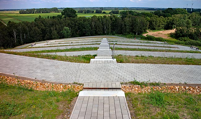
Many roads lead to Rome, but only this one leads to the plateau
What is - albeit with a wink - referred to here as a "mountain" would likely provoke amusement among people from mountainous regions. However, it says something about the surrounding landscape, which is absolutely flat. Thus, despite its relatively modest height of 40 meters, the view from the plateau stretches about 23 kilometers wide across the surroundings, and these could hardly be more diverse. After navigating the moderately inclined, mostly serpentine-shaped, barrier-free paved path, a panorama unfolds to the south, beyond the highway, offering views of many parts of the metropolis.
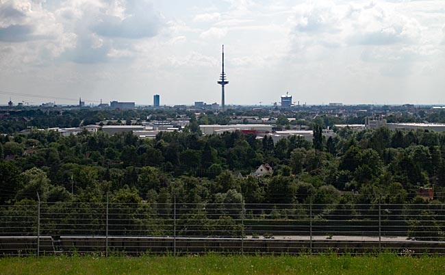
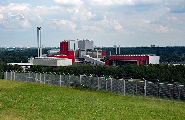
View over Bremen with the TV tower in the Walle district
From the ports and steelworks in Gröpelingen to the Überseestadt and the distinctive TV tower in Walle, from the cathedral with its two church towers in the city center - home to a picturesque market square - and the tourist highlights of Böttcherstraße and Schnoor, all the way to the power plant in Hastedt near the Weser weir and the skyscrapers of the 1970s demonstration project in the Tenever district in the east of the city - one can let one's gaze wander. It is striking that the Hanseatic city, with its large number of trees, is very green and that construction here tends to be low-rise, which is a good thing.
Contrast program: urban ambiance on one side and green cultural landscape on the opposite side of the hill
A green cultural landscape stretching to the horizon can be seen when standing on the viewing platform and turning 180 degrees. Apart from a few small houses along the banks of the Kleine Wümme River, which flows past the base of the landfill, the land is undeveloped. From above, it becomes particularly clear that the name Blockland for this roughly 2,900-hectare landscape is apt, as the digging of drainage ditches in the Middle Ages created a block-like parceling of the area that is still used for agriculture today.
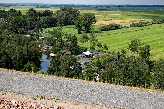
Allotment idyll by the Kleine Wümme and Blocklander Hemmstraße
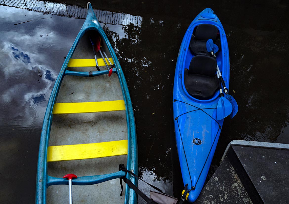
The narrow asphalted road along the Kleine Wümme is very popular with cyclists. In addition to physical exercise, destinations often include one of the cafés or restaurants or even one of the farm shops offering many (organic) products along the well-traveled dike in front of the Wümme - the larger border river between Lower Saxony and Bremen, into which the Kleine Wümme flows. Via a branch road, those with the desire and increased energy can also cycle further to northern Bremen. The two rivers are not the only bodies of water; together with the Maschinenfleet and Waller Fleet, there is plenty of waterway distance that can be paddled in a kayak or canoe. That covers the views from the plateau.
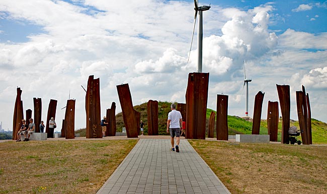
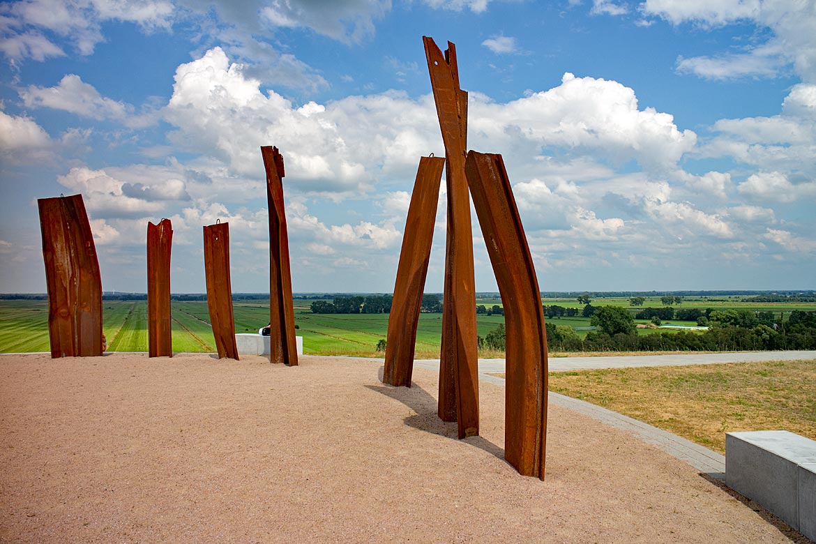
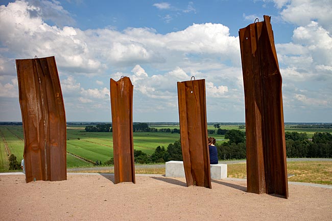
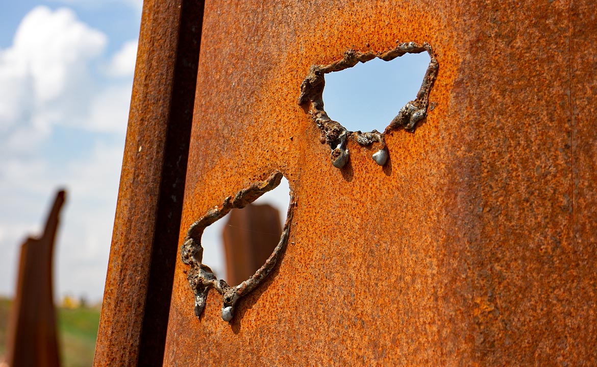
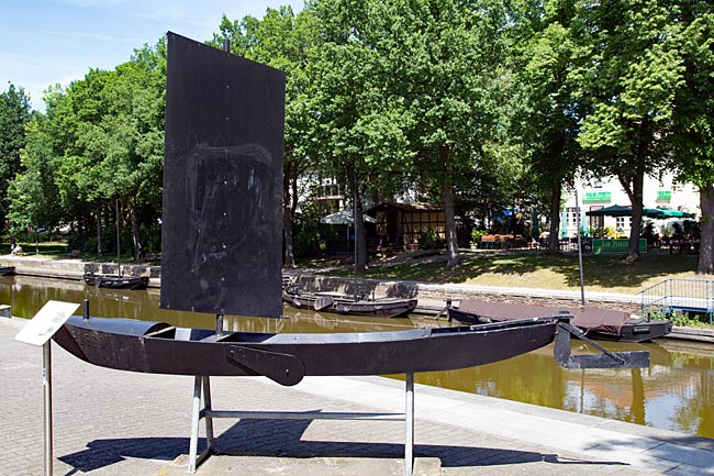
The circle of Metalhenge with steles made of harbor sheet piling
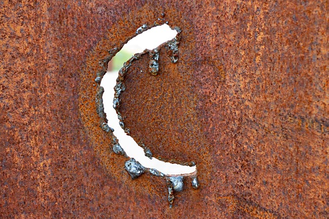
Visitors can also gain insights on the plateau itself, as it is home to Metalhenge, an installation by Thomas Roth that incorporates the hill as part of an overall (art)work. Like a cult site, it stands atop the highest point. The name component "Henge" deliberately evokes the famous stone circle from the Neolithic period in southern England. While the English word "Metal" refers to the old, deformed, and rusty steel harbor sheet pilings that Roth used instead of large stones - a very fitting choice for a port city on one of Germany's largest rivers.
According to an information board at the parking lot next to the starting point of the hiking trail, the circle is "since the beginning of humanity the symbol of wholeness," which is why the circular arrangement of the individually standing, meter-high metal parts was intentional. Incidentally, the perfect form in nature is the sphere. The very different views - city on one side and landscape on the other - are interpreted as the present and the past from which we come, so to speak, the settling down of hunters and gatherers.

Even the sheet pilings were destroyed, deformed, and repurposed
That this process is increasingly destructive, we are currently experiencing not only in climate change but also standing on a landfill, a part of the waste that civilized people have produced in the past. Well, the green-covered - naturally sealed at the bottom - mixture of toxins may not smell to high heaven and is hidden from our direct view, but it stinks metaphorically. Are we getting closer to heaven on the shards of our culture?
People have long erected towering structures or built up hills where the landscape offered no natural elevations in order to create cult sites where they hoped to be closer to heaven and the gods. A landfill is a new development, but it is somehow part of the whole - at least from a human perspective, as much of what we violently separate or energetically ignore comes back to us or was never really gone. This includes old burdens, even if grass has grown over them.
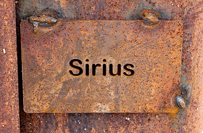
The Dog Star (constellation Canis Major) is the brightest star in the night sky
Speaking of heaven, those who look closely will find metal plates welded onto the steles with names such as Sirius. Like the stones in Stonehenge, the steles on Bremen's hill are aligned according to selected astronomical aspects, with the four cardinal directions being the easiest to identify. Further metal objects oriented to the east point "to the rising points of stars," while those opposite primarily point "to the setting points of the sun and moon at special times," writes Dieter Vornholz on an explanatory information board. The former director of Bremen's Olbers-Planetarium must know, as he advised Thomas Roth with his expert knowledge. That some of these "special times" occur during nighttime or twilight hours - so that something can actually be seen - makes it somewhat more difficult on the one hand, but since the hill and its surroundings are far less affected by light pollution than large parts of the city, it also makes it easier on the other. Well then, admission is free, and access is not time-limited.
Even the holes in the steles have a scientific purpose, such as this semicircle representing a star in the constellation below the horizon in Bremen
In the central area of the circle of metal objects, markings are embedded in the sandy ground. The round labeled plates refer to objects or locations on Earth, including archaeoastronomical sites like Chichén Itzá on Mexico's Yucatán Peninsula, the pyramids of Giza in Egypt, the North and South Poles, or telescopes such as the Teide Telescope. If you were standing in the center of the circle at an eye level of 1.5 meters and could see through the Earth, you would glimpse those places. So it's worth lowering your gaze as well.
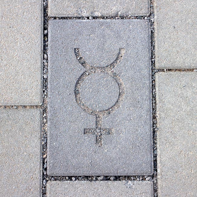
Symbol of Mercury on the Planetary Path
The access path is also a planetary path on a scale of 1:1 billion. Symbols for the planets Mars, Earth, Venus, and Mercury are engraved in stones in the pavement. A matching planetary path app will activate your smartphone when you cross the paths of the planets - provided you have installed the app.
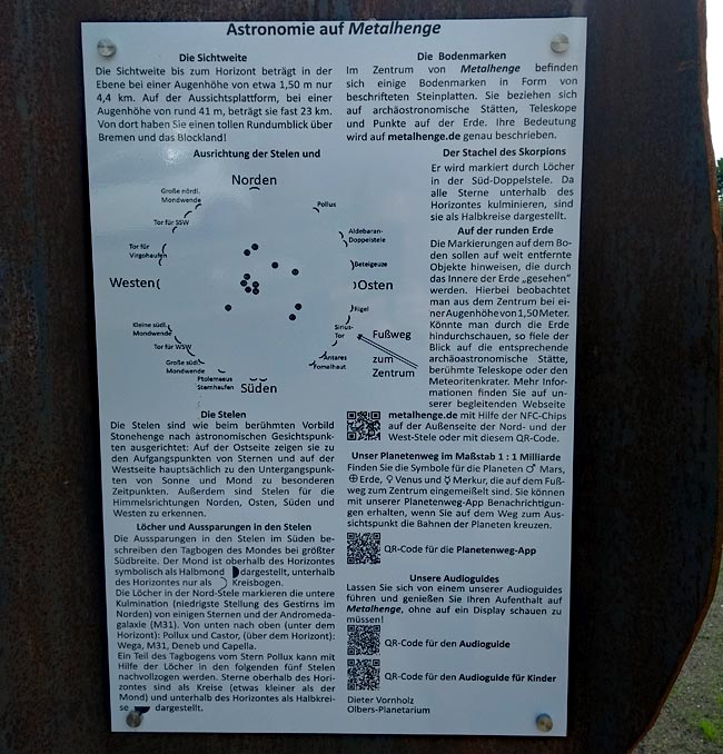
"What does the artist want to convey with this?" Read it yourself! This is how information is provided: Information boards by the head of the landfill and recycling stations of Bremen's waste management, the artist/initiator, and the former director of Olbers-Planetarium, the latter with internet access via QR code, at the car and bike parking lot in front of Metalhenge
For more information, there is a really well-made website and audio guides, including one specifically for children. Conveniently, there are QR codes on one of the information boards at the parking lot (see photo above), so simply scan with your smartphone and off you go.
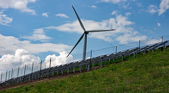
Power generation with photovoltaics and wind power on the landfill
"Energy!" was the command when Scotty needed to beam Captain Kirk up or away. This vision from the first generation of "Star Trek: The Original Series," from the 1960s and 70s of the last millennium, remains futuristic today, even if some might wish otherwise. The fact is that we currently need more energy than ever, and it should be generated as environmentally friendly as possible. Solar and wind power are used for this on the landfill. A photovoltaic system on the southern slope generates around 850,000 kWh of electricity per year. The wind farm consists of a total of four wind turbines, two of which are located on the elevated part of the landfill. The 2-MW systems generate approximately 18,800 MWh of electricity, also calculated annually. Adjacent to the highway, the swb (Bremen's municipal utility) produces district heating for many households in the city at its waste-to-energy plant.
Consumer waste as an energy source
Coclusion: For millennia, humans have observed the universe, created tools to transcend the limits of human vision, and sought to understand how everything is interconnected. Gazing at the stars is a glimpse into the past - a past from which we emerged and that surrounds us in many ways. And in most religions, heaven was the abode of the gods. Some of these astronomical observation sites were places of worship where, by today's standards, barbaric rituals were performed, including human sacrifices. Was Stonehenge one such site?
Metalhenge definitely is not! Let yourself be slightly enchanted by this place. You don't necessarily have to be interested in astronomy, but it is intriguing if you let yourself engage with it a little. A night sky at a location with minimal light pollution is truly impressive. Beyond planets, stars, and rusty steel, there remains an amazing view. The project is a truly creative idea. And consider what you're standing on up there - perhaps your next purchase can wait a bit longer, and the old whatever-it-is will do for a while ...
previous page![]()
![]() next page
next page
Map
Further information
www.metalhenge.de
Arrival: Metalhenge is located on Fahrwiesendamm, which can be reached by car via a loop of the Autobahnzubringer Bremen-Überseestadt. By bicycle, there are two routes from the Walle district to cross or go under the A 27: one via Waller Straße and another along Waller Damm next to Waller Fleet through the allotment area in the Hohweg neighborhood. From the Findorff district, the route goes from Hochschulring into Blocklander Hemmstraße to a small bridge on the left over Kleine Wümme, then back on the other side along Waller Straße until the turnoff to Fahrwiesendamm.
More on Astronomy
Olbers Society Bremen e.V.
c/o Olbers Society registered association
Bremen University of Applied Sciences - Faculty of Business and Nautical Studies
Werderstraße 73
28199 Bremen
Phone: +49 (0)421 167 677 06
Email: olbers@olbers-gesellschaft.de
https://olbers-gesellschaft.de/index.php
Olbers-Planetarium
Bremen University of Applied Sciences
Werderstraße 73
28199 Bremen
Phone: +49 (0)421 40 88 99 300
Email: mail@planetarium-bremen.de
https://planetarium.hs-bremen.de
TELESCOPIUM-Lilienthal Non-Profit Foundation Company Ltd.
Am Staugraben 5
28865 Lilienthal
Phone: +49 (0)171 6152337
Email: info@telescopium-lilienthal.de
https://www.telescopium-lilienthal.de
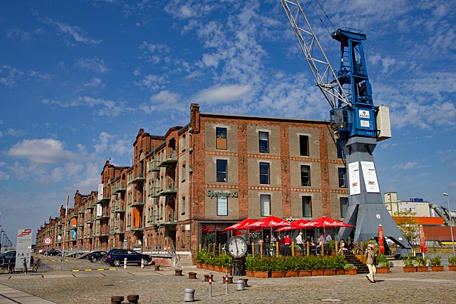
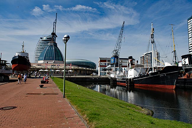
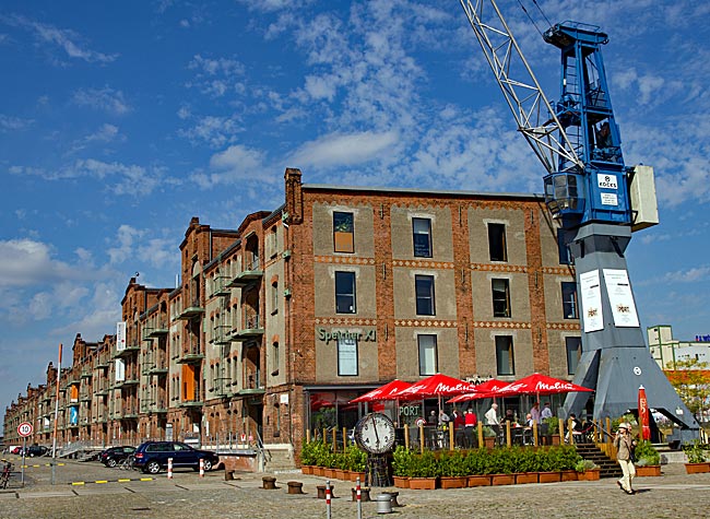
Überseestadt
When the Overseas Port (Überseehafen) needed renovation, the decision was made in 1991 in the Hanseatic city to simply close the basin instead. In 1998, the Overseas Port was finally filled with sand that had been dredged from the Außenweser. Along with the also decommissioned but still existing Europa Harbor as a harbor basin, this formed the basis for the conceptual development and creation of today's Überseestadt.
read more ...
Through Walle district to the industrial ports
The history of Walle began, like that of many other districts in Bremen, long ago as an independent village, more precisely, it started only as the seat of the Ministerial family von Walle. The first mention of the old village dates back to the year 1139. From this family came both farmers and citizens. Thus, with the settlement of more people, the family estate grew into a village around the manor. Walle was incorporated into the Hanseatic city in several steps, first between 1885 and 1902.
read more ...
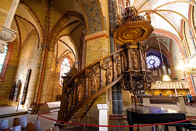
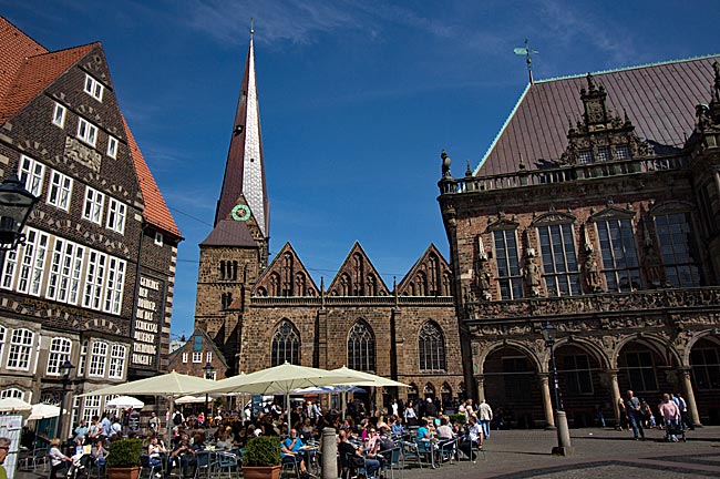
St. Peter's Cathedral
The history of the cathedral, Bremen's oldest church, begins with the Christianization of the region - originally settled by the Saxons - by Charlemagne in the 8th century. While it is uncertain exactly when the first cathedral was built on the highest point of the so-called Bremer Düne (Bremen Sandhill), it was likely destroyed by invading Vikings from Denmark in 858. The subsequent Romanesque structure, begun in 1041 and completed with its two towers in the 13th century, was later remodeled in the Gothic style during the 16th century.
read more
...
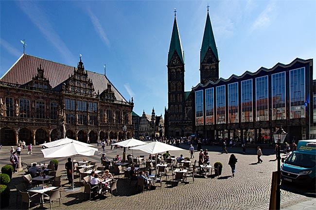
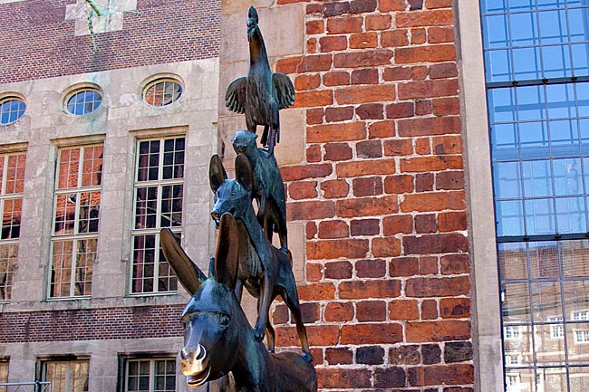
Market square
As it was in the past and as it is today, the market square is the political center of Bremen and also a major attraction for thousands of tourists, undoubtedly due to its unique architectural atmosphere. Almost unobtrusive and plain in appearance, the Bürgerschaft (Bremen's parliament) stands next to the magnificent Old Town Hall.
read more ...
Böttcherstraße
Since at least 1931, the name Böttcherstraße is no longer primarily associated with the scent of wood and the sound of coopers' hammers, but rather with a very special, almost enclosed ensemble of buildings. Over a length of just over one hundred meters, museums, open artist workshops, specialty retailers offering upscale goods, dining establishments, and a hotel create a unique atmosphere between brick and sandstone structures that is unparalleled in Bremen.
read more ...
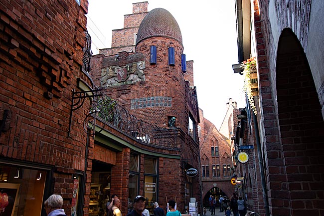
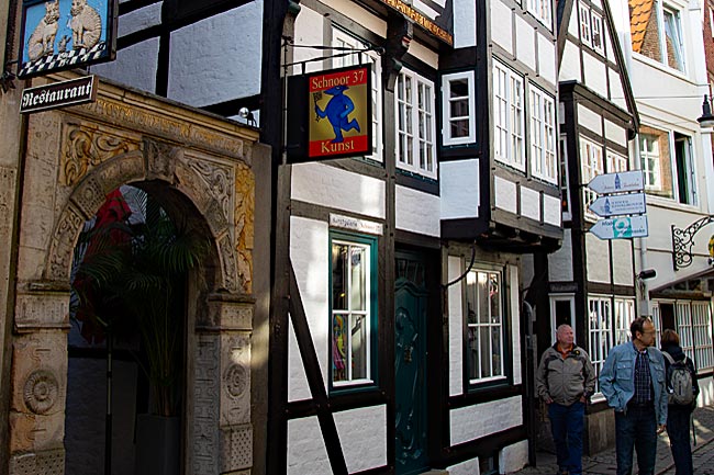
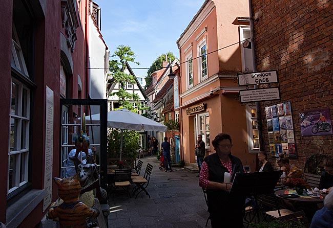
Schnoor
Bremen's oldest preserved neighborhood is the Schnoor. In earlier times, this area was primarily inhabited by fishermen and sailors, as it was here that the Balge - a tributary of the Weser - ran, and one of Bremen's first harbors was located. Many of the small houses date back to the 17th century or have been reconstructed based on historical models. The house at No. 15 in Schnoor Lane, built in 1402 on medieval foundations, is one of the oldest structures in the Schnoor, alongside the Packhaus (1401).
read more ...
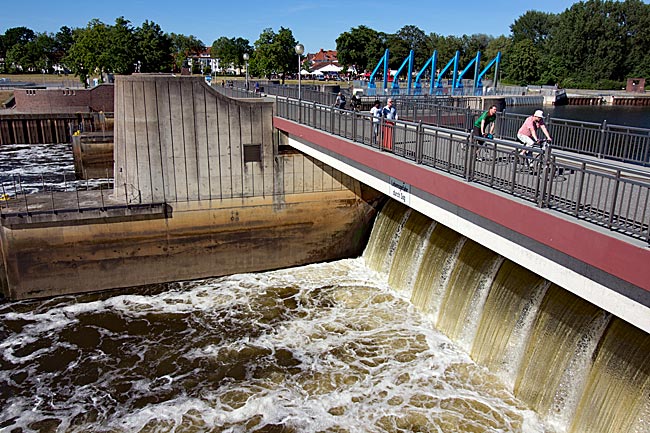
The Weser weir
To make navigation possible, the weir is equipped with locks. Vessels up to 11.45 meters wide are locked through chambers up to 225 meters long. The difference in water levels ranges between approximately three and a half to six and a half meters. The drop in water level made it economical to generate electricity, as was also the case in Bremen. The capacity of the power plant, whose turbines were gradually connected to the grid between 1915 and 1917, was increased in 1926 by the commissioning of additional turbines to such an extent that the generated energy temporarily covered half of the demand in the Hanseatic city.
read more ...
Cycling to Vegesack in northern Bremen
Starting from Bremen Central Station, the route takes you past Bürgerweide, the distinctive Stadthalle (City Hall), Congress Center, and trade fair halls through Findorff along the Torfkanal. This canal, which runs along the edge of Bürgerpark and Stadtwald, was constructed between 1817 and 1826 to transport peat from Teufelsmoor in Lower Saxony near Worpswede to Bremen via peat barges. The journey continues through the green Blockland area to the dike of the Wümme River.
read more ...
Water-based activities in Bremen
Given that Bremen is a city situated along a major river and surrounded by numerous lakes, it's only natural to extend sporting or leisure activities from land to water. The most family-friendly activity on the water is undoubtedly taking a rowboat ride along the canals of Bürgerpark.
read more ...
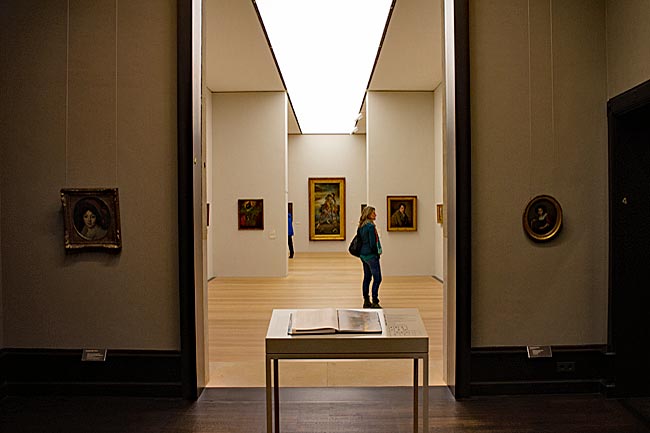
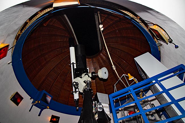
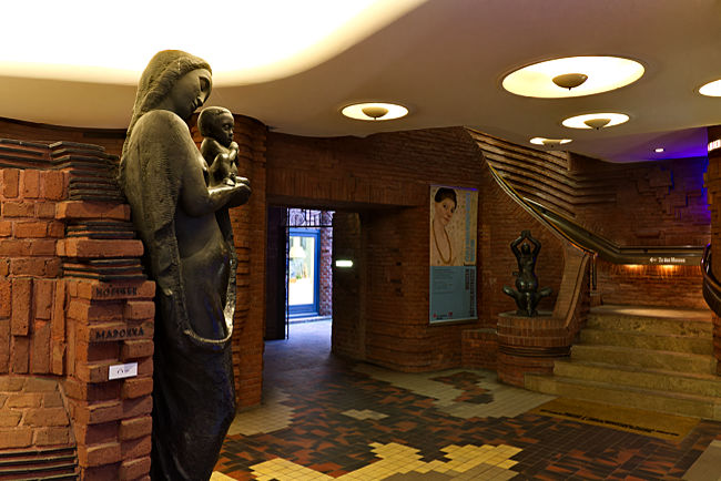
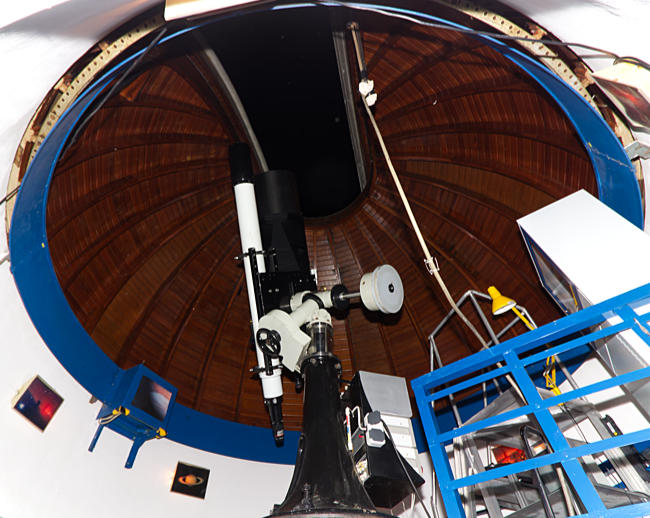
Observatory & Planetarium
On selected days, visitors can also look through the large stationary and smaller mobile telescopes of Walter-Stein Observatory, which are set up on the terrace for the occasion. In the Olbers-Planetarium in the same building, members of the society give lectures on varying topics. Opened in 1952, the Olbers-Planetarium features a dome with a diameter of 6 meters, making it one of the smaller planetariums. It offers 35 seats (including wheelchair-accessible options) for visitors.
read more ...
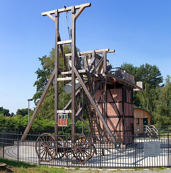
Cycling to Lilienthal
It’s about 11 kilometers from Bremen’s city center to Lilienthal in Lower Saxony, just beyond the city limits. While tram line 4 connects the two places, a bike tour is much more enjoyable. On the Jan-Reiners-Weg, you can cycle through a green landscape without car traffic, and even within Lilienthal itself, the route follows small paths along the Wörpe River with minimal traffic, leading to the town’s historic center. However, it’s also worth visiting the Telescopium on the outskirts of town.
read more ...
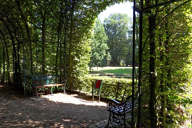
Stadtwald & Stadtwaldsee
The design of Bürgerpark is attributed to Wilhelm Benque, who served as its director from 1866–1870 and again from 1877–1884. Carl Orth succeeded him in the role, and under his plans, construction of Stadtwald (urban forest and park) began in 1907. The site, covering 66.5 hectares north of the railway line, had been donated to the Bürgerpark Association by Bremen merchant Franz E. Schütte the previous year.
read more ...