![]()
![]() exploring Bremen & its surrounding areas
exploring Bremen & its surrounding areas
![]() You are here: tours through the city
You are here: tours through the city
 Round trip:
from the City Center to Weser weir & back (2/3)
Jürgenshof
The Pauliner Marsch was originally pastureland managed by the St.-Paul Monastery, also known as Paulskloster. The Benedictine monastery, built in 1050 near Bremen's eastern city gate and bordering the city wall, was demolished as early as 1523. Today, nothing remains of the buildings in what is now the Ostertor (eastern city gate in german) district - only street names hint at its former existence. The green spaces transitioned from monastic ownership to St. Petri Cathedral or the church, which had to transfer them to the city in 1803. Even into the 19th century, the area was used for grazing; a few horses are still kept here today. A final remnant is the old shepherd's farm of the monastery, now known as Jürgenshof, one of Bremen’s most traditional inns. The existence of the farm on a warf (artificial mound) can be traced back to the first half of the 12th century, though the restored farmhouse at this location dates to 1810. The marsh belongs to the Peterswerder district, and indeed, two small river islands once stood here - hence the name Werder (island), for example, near where the Weser Stadium now stands.
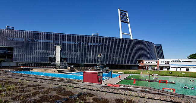
Peeking over the privacy wall: next to the Weser Stadium is one of the few remaining swimming pools in Bremen
Nowhere in the Hanseatic city is there such a high concentration of sports facilities as in the 54-hectare Pauliner Marsch. No fewer than 18 sports fields, a roller sports stadium, and on 7,000 square meters, the Sports Garden with a skate area, artificial turf pitches, various ball game courts, and a climbing wall are spread across the area. Sports at this location have a long tradition; as early as the beginning of the 20th century - before World War I - the first sports facilities were established here, such as a precursor to the Weser Stadium in 1909. Later, during the Weimar Republic, the Stadionbad open-air pool was opened in 1925 in close proximity to today’s stadium.

From a botanical perspective, not a berry but an aggregate fruit: a strawberry at the Erdbeerbrücke (strawberry bridge), which spans the Weser and Werdersee
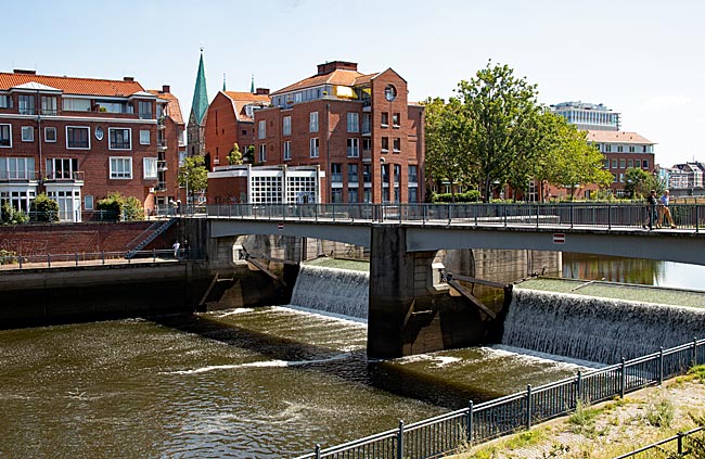
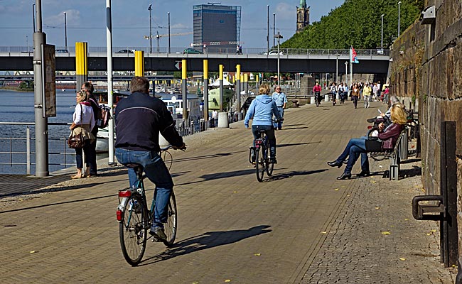
A path leads past the allotment houses of the Gartenfreunde Weserlust e.V. association under the Karl-Carstens Bridge toward the Weser weir. The renaming of the heavily trafficked connection between the two banks of the Weser from "Werderbrücke" to "Karl-Carstens-Brücke" in 1999 honored the former German federal president, who was born in Bremen. In colloquial speech, the bridge is often simply called the Erdbeerbrücke (strawberry bridge) because vast strawberry fields once lay in Habenhausen district in southern Bremen on the other side of the Weser.
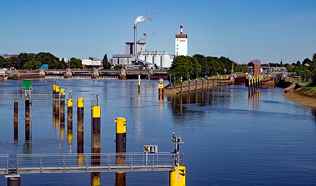
View from the Karl-Carstens Bridge over the Weser with the Weser weir and the double lock
The bridge, which is also accessible to pedestrians and cyclists on one side, crosses the Weser and Werdersee. In between, a step-free spiral walkway leads to Stadtwerder with its allotments, Café Sand, and onward toward the city center past the "upside-down commode," observatory, and planetarium. Despite the constant flow of traffic generating an unpleasant noise, one can still enjoy the view from the bridge for a moment.
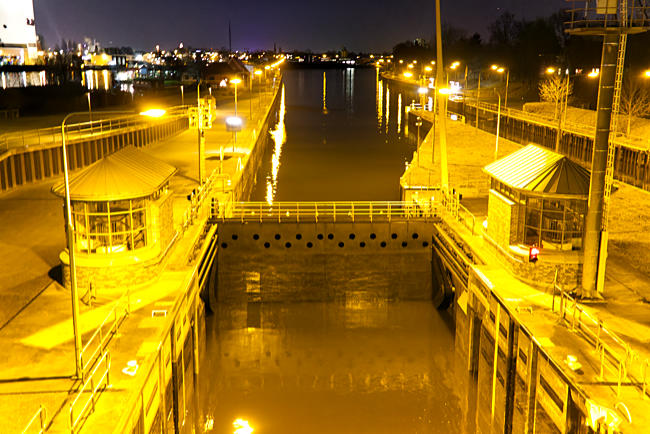
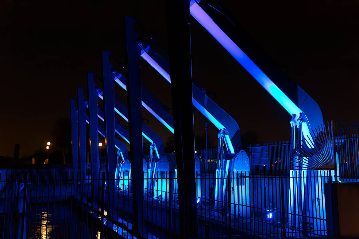
View of the large shipping lock and the Middle Weser at night
Whether in March 1981 the many onlookers on the bridge experienced enjoyment or rather horror remains uncertain. In fact, due to unfavorable conditions, so much water flowed down the Weser from inland that the partially no longer fully functional weir could not handle the volume. As a result, the summer dike at two points near the bend in front of and behind the weir burst, flooding the retention area behind it. Although this area was designed to hold water, no one really expected such an event to occur. The force of the water destroyed 120 allotment houses and washed some of them whole into the river, where they drifted toward the city center. The subsequent flood protection measures make a repetition of such a scenario today seem rather unlikely.
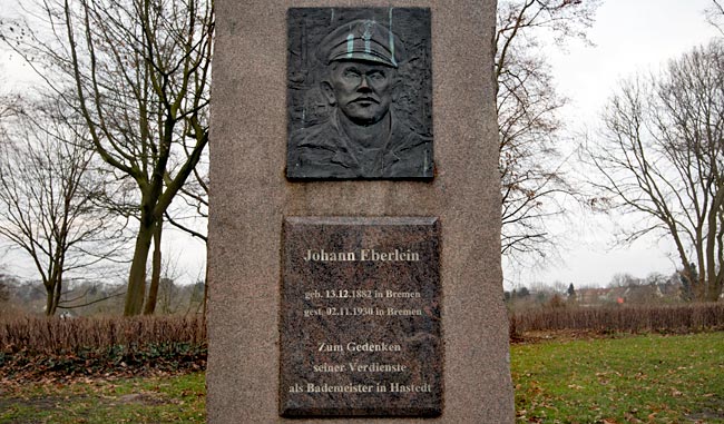
Monument for the lifeguard Johann Eberlein
Even before the first Weserwehr was completed in 1911, there had been a bathing spot since 1886/87 slightly downstream from the weir in what is now the Hastedt district of Hemelingen. In 1926/27, it was relocated downstream roughly halfway between the weir and the bridge. In the 1920s, the lifeguard Johann Eberlein was in charge and is said to have saved 73 people from drowning during those years. A memorial stone was erected in his honor in the summer of 1988 within the park-like facility established in 1932. Today, no one may bathe here anymore; the remains of the facilities were demolished in 1959. Sports are still practiced and played on Eberleinweg between the monument and Hastedter Osterdeich - just without water.
A simple tool
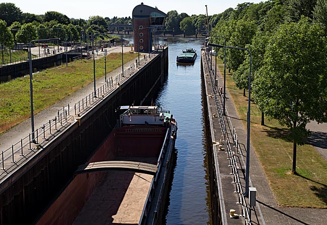
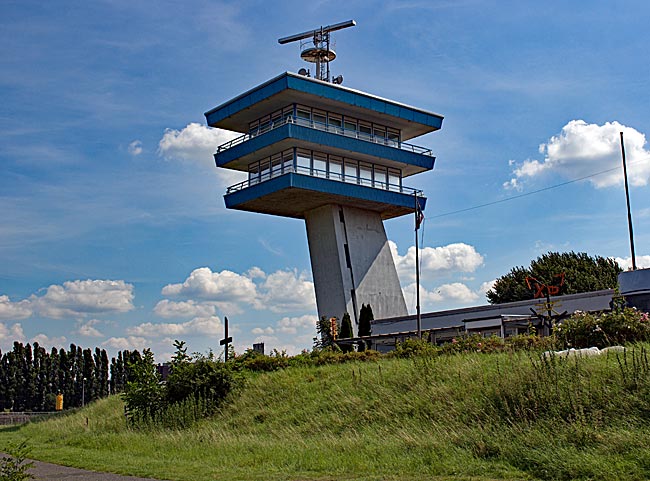
The Weser weir in Hastedt district is the last weir on the Weser before it flows as the Lower Weser and finally as the Outer Weser past Bremerhaven into the North Sea. While the water level upstream is kept at roughly the same height, downstream, ebb and flow alternate continuously. To keep the river navigable, two lock chambers were built. Those interested in learning more about the weir can find detailed information here. A footpath and cycle path make it easy to cross the facility and reach the river island Stadtwerder.
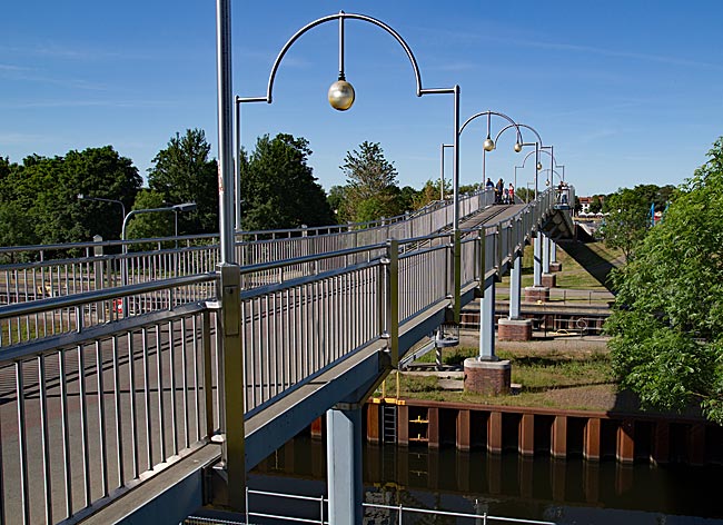
The path first crosses the weir and then bridges the two lock chambers. From here, one can also watch as inland or other ships are locked through
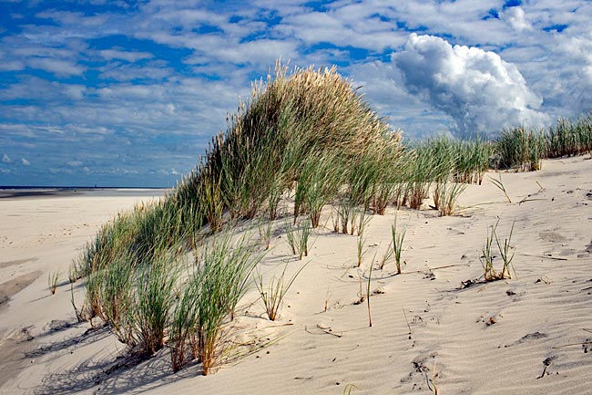
If you initially head left and follow the asphalted road after a right turn through the nature reserve with the New Weser created by the 1981 flood, you will soon reach the eastern end of Werdersee. Today covering 370,000 square meters, it is the largest lake in the Hanseatic city. Originally, however, the lake was much smaller and technically isn’t a lake at all but part of the Kleine Weser (Little Weser), which since the Middle Ages ran several kilometers upstream alongside the Weser before ending blindly in the land. Until the construction of the weir at Teerhof in 1968, the water level of what was also called the Alte Weser (Old Weser) fluctuated with the tides like that of the Lower Weser.
Weir on the Kleine Weser. The bridge leads to Teerhof, the continuation of Stadtwerder; another bridge spans the Weser from Teerhof to the inner-city Schlachte
When the Weser flooded, the Kleine Weser would intentionally overflow as a protective measure via a specially constructed flood channel. Between 1953 and 1960, this channel was relocated roughly two kilometers behind the weir in Hastedt (built in 1911) as part of restructuring efforts to improve flood protection. As part of the overall construction project, a land bridge was also created, separating the approximately three-meter-deep Werdersee from the Kleine Weser - though not entirely. As early as the 1930s, plans existed to create a lake with a regatta course under the then city building director. From 1953 onward, it was garden and landscape architect Wilhelm Hübotter who dedicated himself to designing the lake and its surroundings.
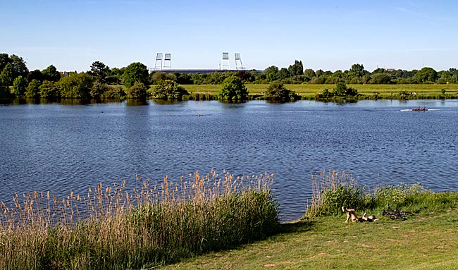
Part of Werdersee; in the background, the floodlights of Weserstadion rise high
To this day, the park-like facility with sunbathing areas, playgrounds, and swimming spots is a popular destination for those who enjoy nature and water. The 1981 flood revealed that the protective measures were insufficiently dimensioned. The dike breach and subsequent changes to the protection concept altered the landscape around the eastern part of the lake, extending it by roughly one kilometer. Even today, the Werdersee has a regulated inflow at its eastern end from the higher-lying Mittelweser (Middle Weser), which serves as a fish pass due to its natural design while also being a popular spot for small children to splash around, as the water level is relatively low in places. In summer, many people swim at the lake’s swimming spots or sit and play under the ground oaks and on the lawns. Twice each May, the Great Bremen Rowing Regatta takes place on the lake, with six lanes marked by chains with red and white buoys stretching 1500 meters in length. The event, which first took place in 1879 and attracts teams from across Germany, typically draws several thousand spectators.
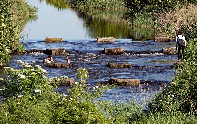
Fun in the water of the inflow at the eastern end of Werdersee
Further information
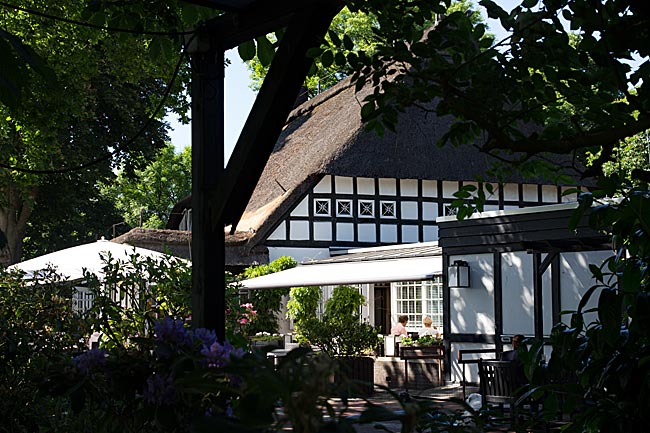
www.cafe-sand.de
www.hal-oever.de
https://becksambiente.de
www.weserterrassen.com
www.werder.de/fankurve/stadionerlebnis/wuseum/
www.Bremer-baeder.de
www.juergenshof.com
www.sportgarten.de
www.derkuhhirte.de
www.stellplatz-bremen.de
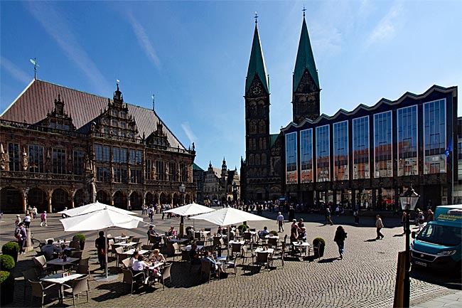
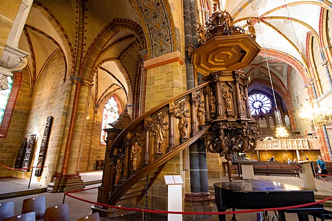
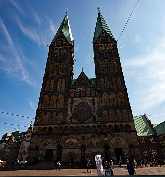
St. Peter's Cathedral
The history of the cathedral, Bremen's oldest church, begins with the Christianization of the region - originally settled by the Saxons - by Charlemagne in the 8th century. While it is uncertain exactly when the first cathedral was built on the highest point of the so-called Bremer Düne (Bremen Sandhill), it was likely destroyed by invading Vikings from Denmark in 858. The subsequent Romanesque structure, begun in 1041 and completed with its two towers in the 13th century, was later remodeled in the Gothic style during the 16th century.
read more ...
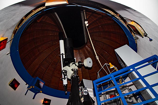
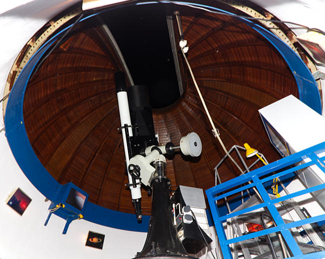
Observatory & Planetarium
On selected days, visitors can also look through the large stationary and smaller mobile telescopes of Walter-Stein Observatory, which are set up on the terrace for the occasion. In the Olbers-Planetarium in the same building, members of the society give lectures on varying topics. Opened in 1952, the Olbers-Planetarium features a dome with a diameter of 6 meters, making it one of the smaller planetariums. It offers 35 seats (including wheelchair-accessible options) for visitors.
read more ...
The Weser weir
After the old Weser weir from 1911, one of seven weirs on the Weser, had become dilapidated, a newly built Weser weir was put into operation in 1993. To make navigation possible at all, the weirs are equipped with locks. In the chambers up to 225 meters long, inland vessels with a maximum width of 11.45 meters are locked through. The difference in water levels ranges between approximately three and a half and six and a half meters. As in the past, electricity is still generated by hydropower today. The weir is accessible to pedestrians and cyclists. There is something to see here.
read more ...
From the Weser weir through Hemelingen Harbor to the marina and to the beach
By bike from the Weser Weir in the Hastedt district through Hemelingen Harbor to the marina and the public Hemelingen beach, a small idyll in an industrially shaped environment. Hemelingen Harbor was first put into operation in 1903, and since then, much has changed. Nevertheless, harbor life still holds a certain charm if one is open to it.
read more ...
A stroll through the Neustadt
The Old Neustadt was only properly established as part of the district in the 17th century. One reason for this planned expansion of the city was the increasing threat posed by advancements in weaponry. Remnants of the defensive walls built at that time still exist today as parks, but there is much more to discover, such as the Little Roland.
read more ...
Through Woltmershausen to Lankenauer Höft
A truly maritime bike tour takes you from the Stephani Bridge through Hohentorshafen and Woltmershausen all the way to Lankenauer Höft, which is almost entirely surrounded by water. Behind the Höft, several ships, including the 1957-built tugboat Greif, are moored in an unrestricted section of Neustädter Harbor. This view of the harbor marks the end of this tour.
read more ...
Cycling in Bremen & Surroundings
Bremen is one of the most bicycle-friendly cities in Europe. This is due, on the one hand, to the generally pleasant cycling conditions in the North German Plain, which has no significant inclines or slopes, and on the other hand, to the promotion of cycling by municipal policies, partly to reduce inner-city car traffic and the associated cross-border air pollution from fine dust and nitrogen oxides.
read more ...
Water-based activities in Bremen
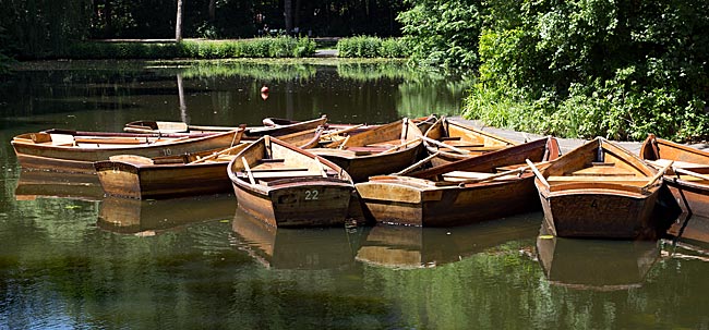
Given that Bremen is a city on a major river with numerous lakes, it makes sense to extend sports or other personal water-related activities from land to water. The most family-friendly activity on the wet element is certainly taking a rowboat ride along the canals of Bürgerpark.
read more ...
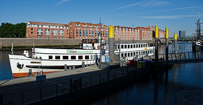
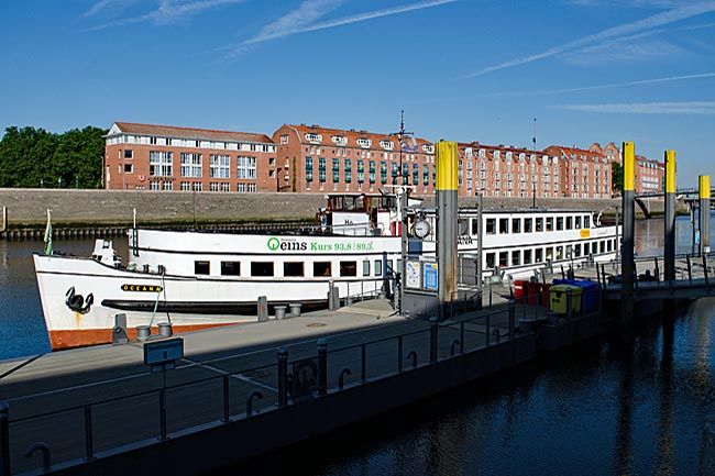
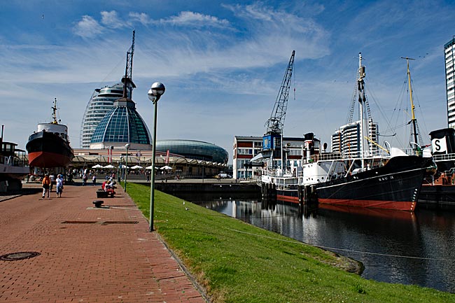
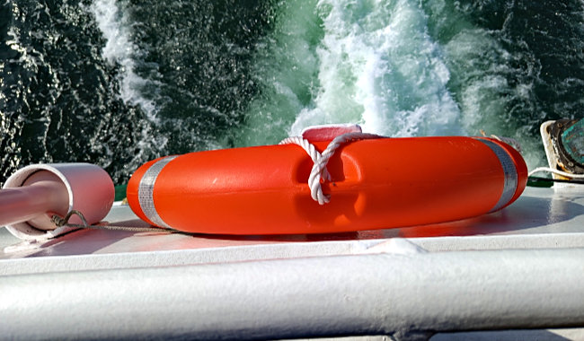
Weser cruise from Bremen to Bremerhaven
Of course, you can take a car for a visit to Bremerhaven from Bremen or board the regional train at the main station. However, with suitable weather and enough time, it is more interesting to cover the route on the Weser by ship. The shipping company "Hal över" operates the connection from May to September. The ship departs from the Martinianleger near the city center along the Schlachte. Those who wish can even take their bicycle with them; additionally, you can pre-book a breakfast onboard.
read more ...