![]()
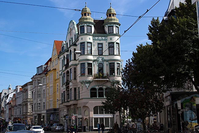
![]() exploring Bremen & its surrounding areas
exploring Bremen & its surrounding areas
![]() You are here: worth seeing in the surroundings
You are here: worth seeing in the surroundings
 Cuxhaven - a day trip (3/3)
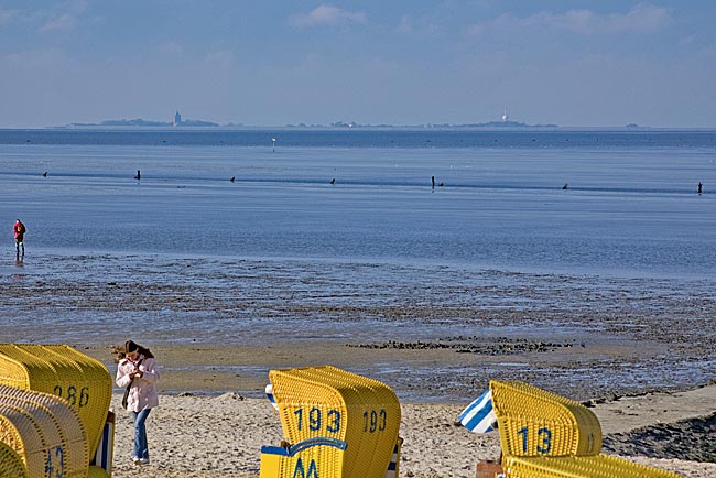
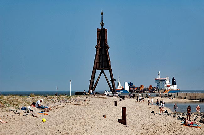
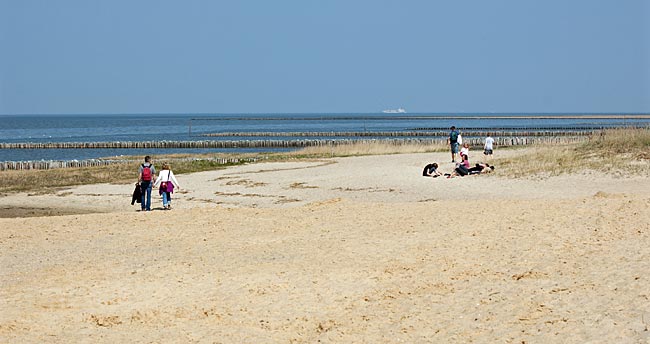
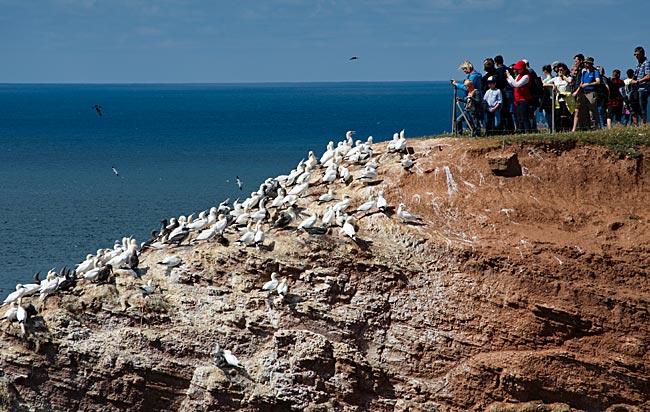
View from the beach to Neuwerk Island
To reach the approximately 12-kilometer-distant island, which by the way belongs to Hamburg, it takes between two and a half to three and a half hours depending on your fitness level. A small tip: Wear old shoes if you don’t want to go barefoot. After a stay with a small snack, you can later return to Cuxhaven by ship after the tide sets in and take a bus of the Bäderlinien back to Duhnen or Sahlenburg. Since the mudflats can become extremely dangerous if you are surprised by the tide, be sure to inform yourself about the changing tides and any emergency behaviors before embarking on a solo mudflat hike. The helpers from DGzRS with their rescue cruiser may be fast, but it can just as quickly be too late.
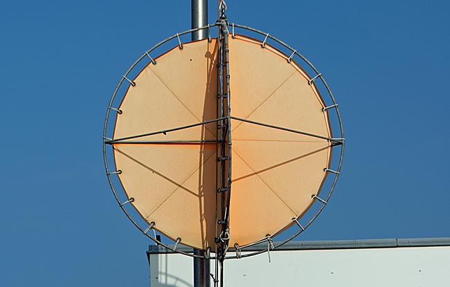
If this signal is raised, you should leave the mudflats for your safety
Back in Duhnen, we continue toward Sahlenburg. Shortly after leaving behind the hotel strip on Duhnen’s promenade, the beach suddenly ends and transitions into a green strip. This so-called "Duhner Anwachs," which has formed since 1936 through land reclamation measures, now serves as a high-water resting place for birds and may not be entered at any time of year. However, from an observation tower, you can observe the birds from afar without disturbing them, assuming you have binoculars or a telephoto lens, unless you prefer to use the fixed binoculars by inserting coins.
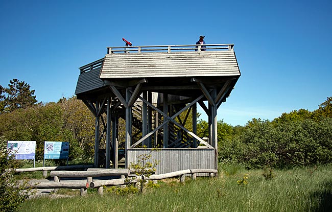
Observation tower between Duhnen and Sahlenburg
Behind or next to the observation tower lies the Duhner Heide, a geest landscape with heath vegetation. As part of the "Niedersächsisches Wattenmeer" National Park and as a protected rest zone, it is preserved. Nevertheless, a roughly 2-kilometer circular path leads through the area for pedestrians.
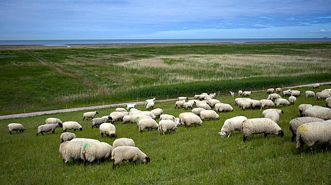
Coastal protection with fur: sheep on the dike near Duhner Heide, keeping the grass short and compacting the soil
Numerous signs along the route inform visitors about flora, coastal protection, the ebb and flow of tides, as well as the power and significance of the wind. More about the UNESCO World Heritage Site Wadden Sea can be learned at the Wadden Sea Visitor Center a bit further along the path in Sahlenburg.
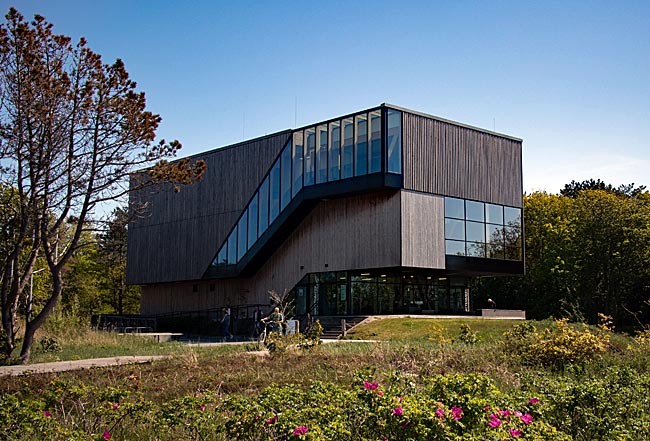
A meeting point for interested visitors: the Wadden Sea Visitor Center in Sahlenburg
Those who, after visiting the center ("theory") - or even without doing so - wish to learn more in "practice" can set out during low tide on an exploratory walk across the exposed seabed and see what nature has left behind. For example, seaweed. The macroalgae grow on fixed objects at the seafloor. They depend on surface light to survive, which in the North Sea corresponds to a depth of about 15 meters, based on the water level at low tide (ebb). Below that, it becomes too dark due to water turbidity from suspended sediments.
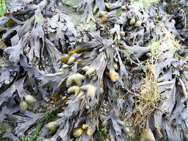
Seaweed also serves as food for sea urchins. The thickenings at the ends are gas-filled floatation devices that keep the plant near the light-filled water surface when the high tide (flood) covers it again
"Help yourself, take a bite." A joke? Only slightly, because these iodine-rich plants are already used today as a food source along numerous coasts worldwide or processed for use in agriculture.
What else is there to discover in the mudflats? Many shells and crabs remain only as dead remnants; the rest has often already been eaten by seagulls. But not everything that lives in the mudflats is visible at low tide. Some animals also burrow into the sand or live there. You can learn more about this on a guided mudflat hike, or you can dig very carefully yourself.
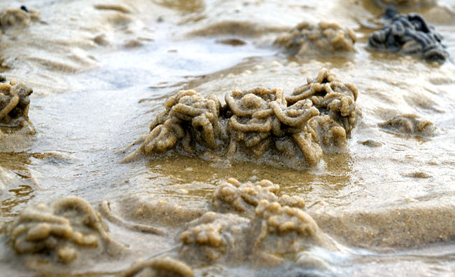
What’s that? Poop piles in the mudflats! The lugworm is an important active part of the wadden sea ecosystem in the North Sea. The 20- to 40-centimeter-long worm eats sand and excretes the indigestible remains every 30–40 minutes at the exit of its tube system. Not only mudflat hikers can watch as the piles grow; some seabirds try to grab, pull out, and eat the worm just beneath the surface at that very moment.
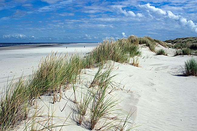
In Sahlenburg, the beach returns as well. With this district, we have reached the final stop of our excursion, just like the small beach train that has already encountered us several times along the way. At first glance, Sahlenburg seems almost like a smaller, quieter sister to Duhnen. Those who wish to set out for Neuwerk from here will find the same conditions and options as in Duhnen; the route is even slightly shorter at about 8 kilometers.
Beach in Sahlenburg
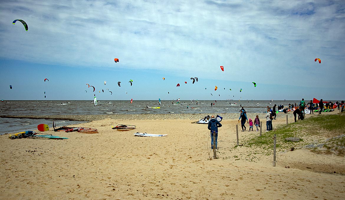
Part of the beach is designated for water sports enthusiasts like kiteboarders and surfers, while another section serves as a dog beach, making Sahlenburg particularly popular with dog owners. Many of them have a permanent or time-limited spot on the fairly large campsite that stretches behind the dike promenade.
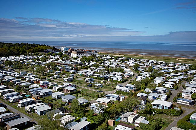
Aerial view of part of the campsite and the wadden sea; to the left, part of the Wernerwald
Beyond that, Sahlenburg has something special to offer: the Wernerwald (forest) with a playground, climbing park, and outdoor swimming pool, making the district even more attractive for diverse leisure activities.
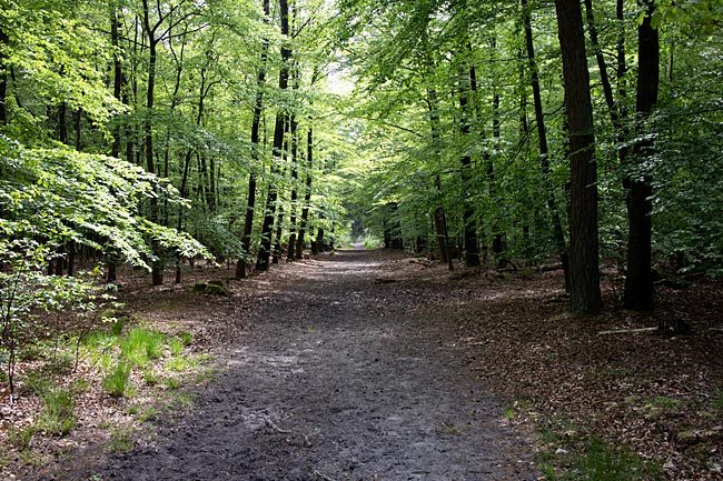
Stroll through the Wernerwald
What frequently occurs along the Baltic Sea namely, that forest areas extend directly to the water’s edge, is extremely rare in this form along the North Sea. The Wernerwald is the only forest of its size along the German North Sea coast that grows directly at the transition to the Wadden Sea. The name of this mixed forest dates back to its founder, Hamburg official Werner, who had advised afforesting the 315-hectare plot of land, which was quite depleted at the time.
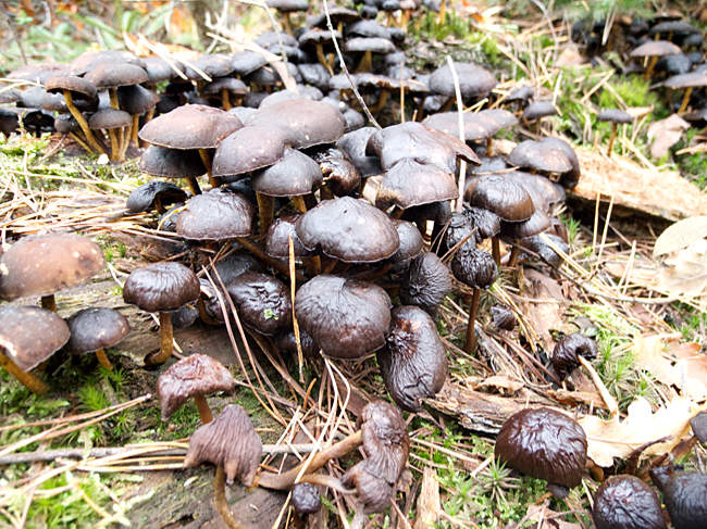
Little is cleared in the Wernerwald; deadwood is largely left in place and serves as a food source and habitat for fungi and small animals
That was in 1880. After overcoming initial difficulties and more than 120 years later, it has become a forest that is equally popular among cyclists, runners, equestrians, and walkers. But campers also find shady spots on a campsite here, and for refreshment, there’s a swim in the tree-surrounded outdoor swimming pool.
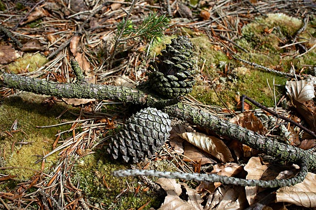
Pinecones on the forest floor
previous page![]()
![]() next page
next page
Map
Further information
Joachim-Ringelnatz-Museum
Südersteinstraße 44
27472 Cuxhaven
Phone: +49 4721 394411
Email: ringelnatz@ewetel.net
www.ringelnatzstiftung.de
Windstärke 10 (Wind Force 10)
Wreck and Fishery Museum Cuxhaven
Ohlroggestraße 1
27472 Cuxhaven
Phone: +49 4721 700-70850
Email: windstaerke10@cuxhaven.de
www.windstaerke10.net
www.cuxhaven.de
https://feuerschiff-elbe1.de
https://hapaghalle-cuxhaven.de
www.dickeberta.de
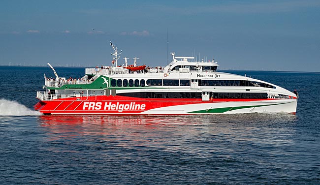
Trips to Helgoland and Neuwerk
A catamaran to Helgoland departs from Hamborn, with stops in Wedel and Cuxhaven. www.helgoline.de
easide resort ships from Cuxhaven to Helgoland and Neuwerk:: https://www.cassen-eils.de
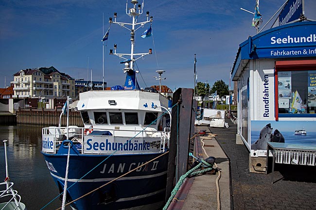
Trips to the Seal Banks
www.cuxhaven-schifffahrt.com
https://reederei-narg.de
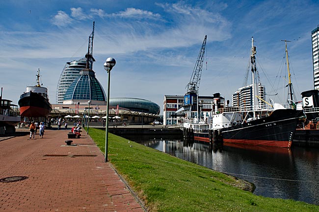
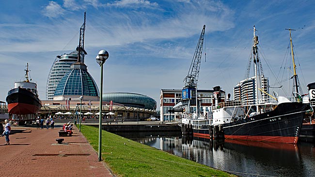
Bremerhaven in general
Bremerhaven was only founded in 1827. To secure Bremen's status as a port city amid the threat of the Weser - Bremens lifeline - silting up, Bremen acquired 342 acres (morgen) of land from the Kingdom of Hanover for 74,000 talers under then-mayor Johann Smidt. About 60 km downstream from Bremen, this land became home to the first urgently needed seaport built by Bremen: the so-called Old Harbor, completed by 1830.
read more ...
Bremerhaven - Zoo am Meer (Zoo by the Sea)
In addition to the 19th-century harbor facilities, the Zoo am Meer is the oldest attraction on the site between the Weser River and the pedestrian zone. It opened in 1928 under the name "Tiergrotten." The enclosures house polar bears, seals, penguins, various bird species such as gannets and keas, reptiles like turtles, raccoons, Arctic foxes, pumas, monkeys, and others - almost 50 animal species in total.
read more ...
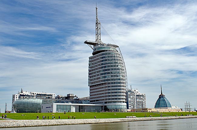
Bremerhaven Havenwelten
Since early 2008, Bremerhaven has not only had a new tallest building but also a new landmark in its Weser-side skyline with the ATLANTIC Hotel SAIL City, which rises 147 meters directly behind the Weserdeich. Architecturally, the structure perfectly embodies a maritime city - it stands like a powerful, rounded ship's superstructure. On the 20th floor, at a height of 77 meters, there is an observation deck (SAIL City) that is also accessible to non-guests.
read more ...
German Emigration Center Bremerhaven (Deutsches Auswandererhaus®)
Opened in 2005, the German Emigration Center® vividly and engagingly presents the history of emigration to America across five eras, spanning from 1830 to 1974. In total, 7.2 million people departed from Bremerhaven to seek a new home and build a new life beyond the Atlantic. For its emotionally compelling and historically grounded exhibition, the museum received the European Museum Award in 2007.
read more ...

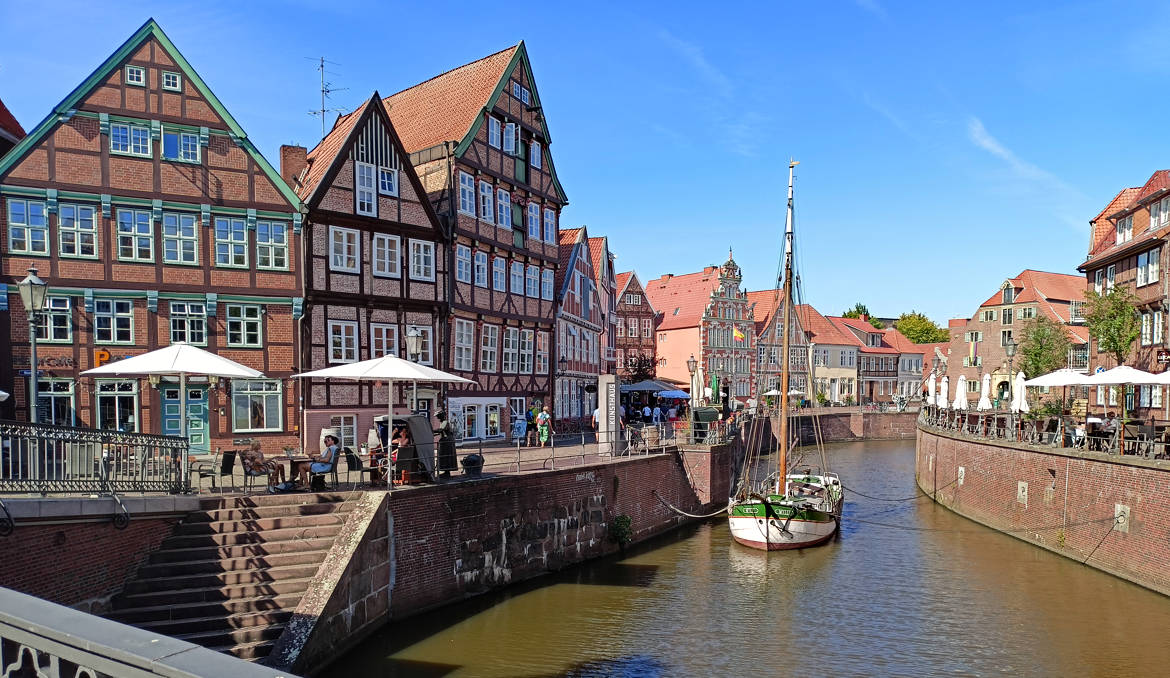
Stade - on the banks of the Schwinge River
Do you know Stade? No? What a shame! Then feel free to read on if you'd like to learn about this smaller Hanseatic city on the Elbe, neighboring the much larger Elbe metropolis of Hamburg. As is often the case, the tourist's gaze doesn't fall on the entire city but rather focuses here on the historic city center and a bit of its surroundings. In our opinion, Stade is a beautiful and worthwhile destination for a short visit or even a few extra days.
read more ...
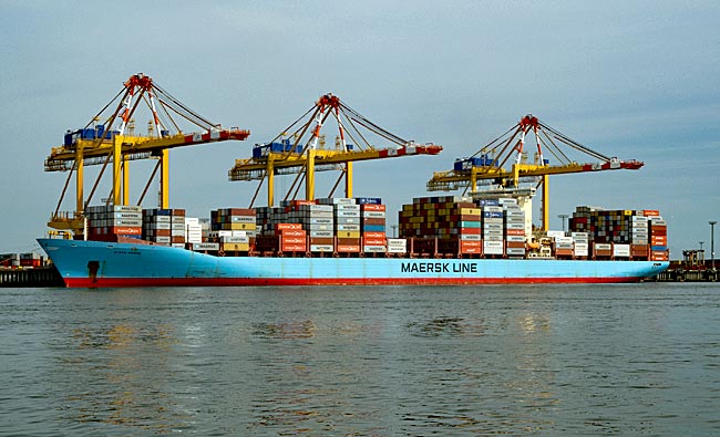
Bremerhaven - Überseehafen (Overseas Port)
In addition to the Old Harbor (now the Museum Harbor), which was the first to be built, other ports were later added. Adjacent to the New Harbor lies Kaiserhafen I, the first in a series of additional harbor basins. Even a glance into this initial section of the expansive port area reveals a different world of maritime activity - one of large ships. And we will see even larger ones along the five-kilometer-long quay on the Weser.
read more ...
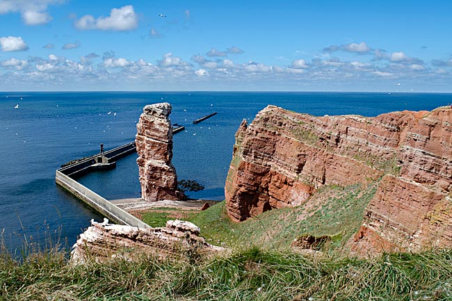
Heligoland - a day trip
Germany's only supposed high-seas island is a destination for thousands of visitors each year, most of whom are day-trippers during the warmer months. And yes, admittedly, Heligoland isn't immediately in Bremen's surrounding area. However, it can be reached as a day trip from Bremerhaven and Cuxhaven - which is why we decided to visit.
read more ...
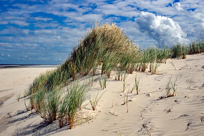
The East Frisian Island Wangerooge
Among the inhabited East Frisian Islands, Wangerooge is the second smallest (7.94 km²) after Baltrum and car-free, making a stroll through town much more pleasant compared to other islands, especially since distances can easily be covered on foot. From the small train station, you're just a few steps away from the heart of the village, quickly finding yourself in front of the unmistakable Old Lighthouse, which now houses the island museum. From 1856 to 1969, this lighthouse served as a maritime navigation aid, guiding ships safely along their routes. Just how far its light could be seen becomes clear when you climb the 149 steps to the lantern room—from there, you can step out onto the surrounding gallery and enjoy a sweeping view of the island and the North Sea.
read more ...
Wilhelmshaven – Seaside City on the Jadebusen
It's hard to imagine Wilhelmshaven without its naval presence, as the city only developed after a naval base was built in the 19th century. Even today, the German Armed Forces (Bundeswehr) maintain a large base here with several squadrons. Yet, there is much more to discover in this port city beyond its military significance.
read more ...